Thinking about using drone video to market your Mapleton home or new build? Buyers want to see how a property connects to daily life, not just four walls and a roof. Aerial storytelling helps you highlight commute routes, parks, and the Maple River corridor while showcasing craftsmanship and lot advantages. Below, you will learn what to film, how to stay compliant, and how to deliver a polished package that stands out in the Fargo metro. Let’s dive in.
Why aerial storytelling works in Mapleton
You live in a place where connectivity matters. Mapleton’s proximity to Interstate 94 is a key selling point for commuters into Fargo and nearby employment centers. Smart aerials show real access, not just a map pin.
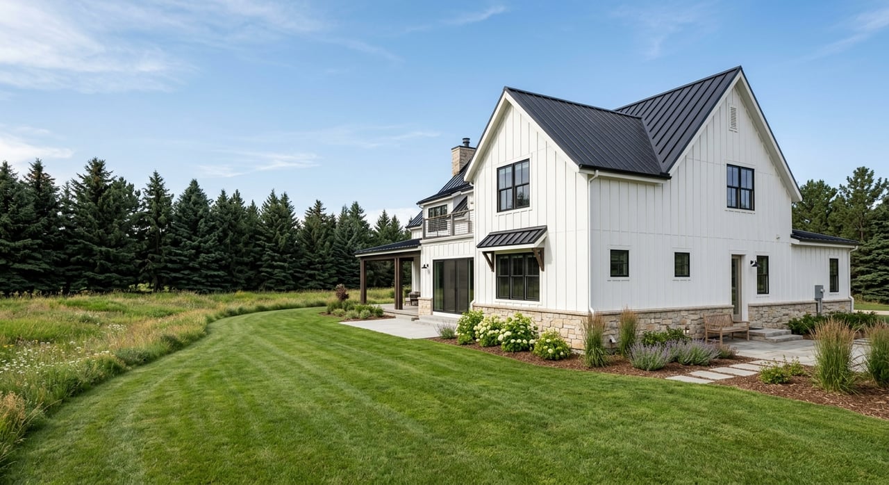
Lifestyle is the second pillar. The Maple River corridor, tree buffers, and nearby parks add real value for relaxation and recreation. Aerial footage helps buyers understand that setting in seconds.
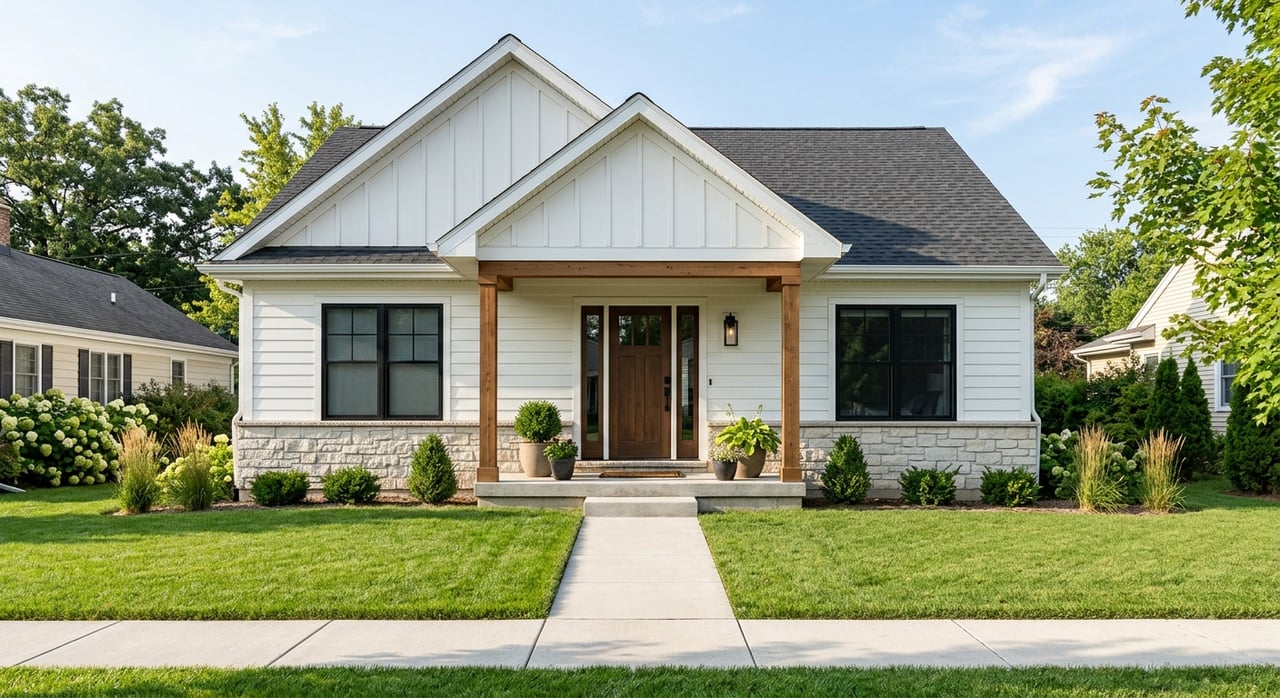
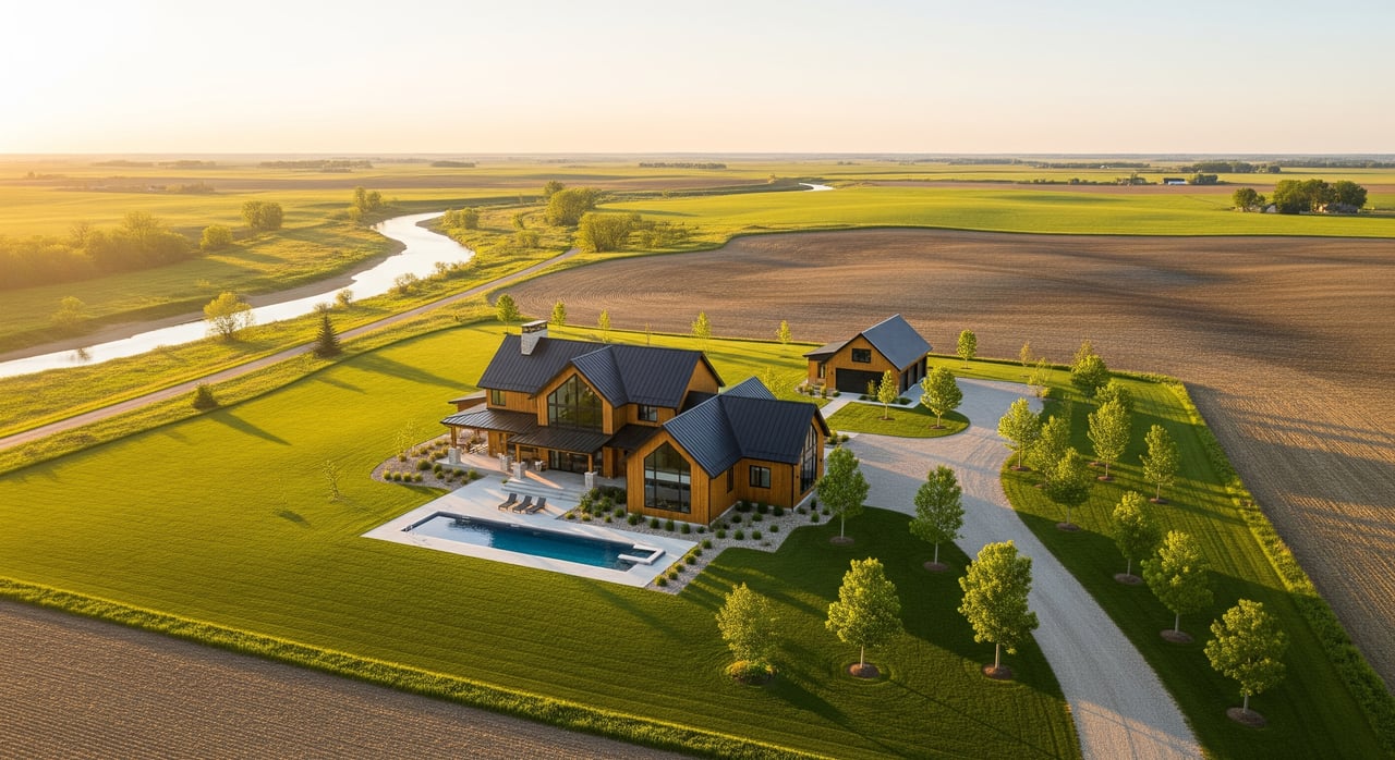
Quality is the third pillar. Luxury and new-construction buyers expect proof of design, materials, and lot flow. From hero reveals at twilight to top-down roof shots, the right drone footage answers those questions quickly and credibly.
What to highlight from the sky
I-94 access and real connectivity
Show the actual commute corridor buyers will use. Start with a wide shot of I-94, then transition to the neighborhood and the property to establish real proximity. Avoid implying ramps are closer than they are by relying on clear visuals and accurate labeling in post.
If you include drive time graphics, use realistic estimates and identify the corridor rather than promising exact times. Keep any ramp labels accurate and conservative. The goal is to show convenience without overclaiming.
Maple River and parks context
Use low altitude, lateral moves along the Maple River to convey tree cover, bends, and greenbelt feel. If there are public access points or trails near the listing, capture short, continuous clips that hint at continuity without flying over people.
When you describe a park as near or within walking distance, verify exact names and distances first. If you are not certain, say “close to parks and green space” and let the footage support the claim.
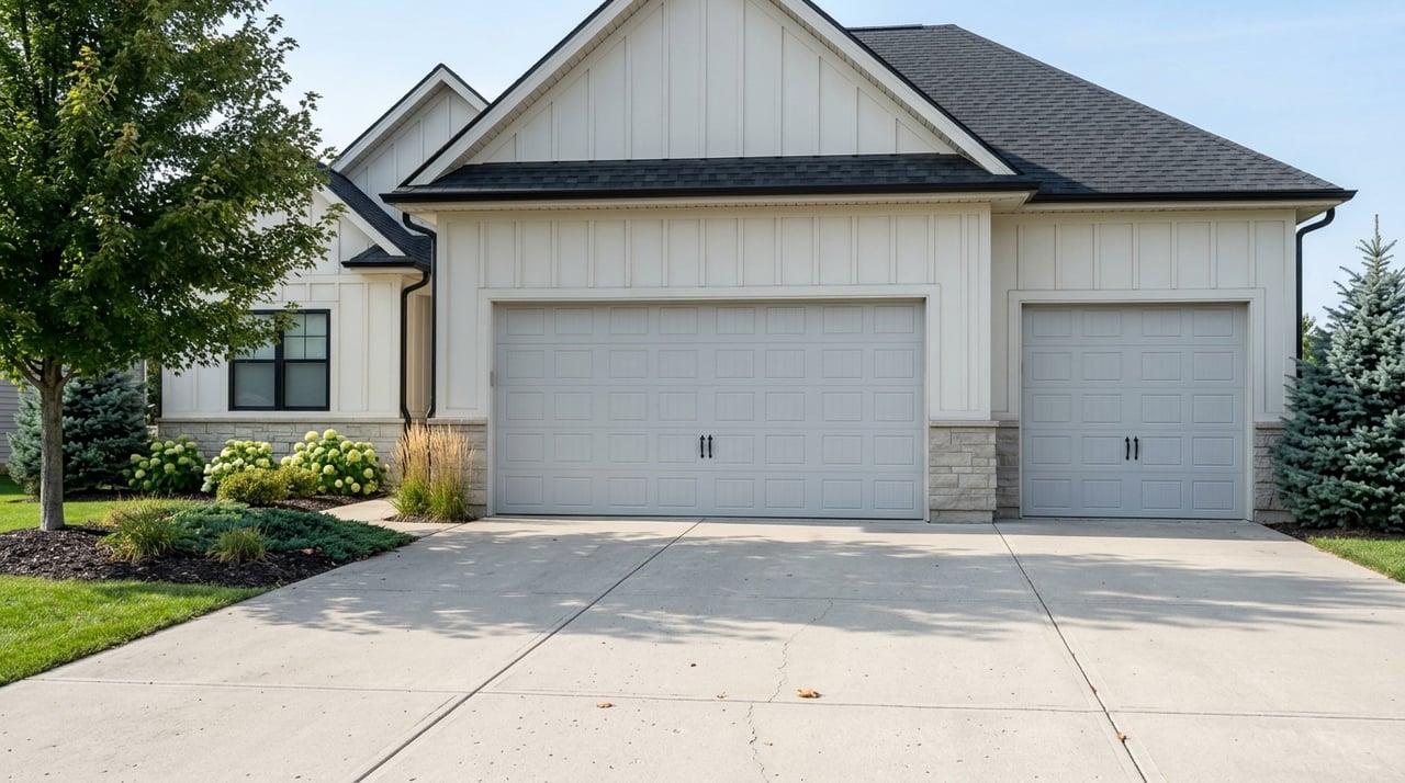
Luxury and new-build features
Buyers want to see design and flow. Use a slow hero reveal to frame the façade, then move to sequences that show driveway approach, guest parking, backyard amenities, and view orientation. Top-down shots help buyers understand lot lines, landscaping, and roof quality.
At twilight, exterior lighting and pool illumination read beautifully on camera. Night operations require additional safety steps, so confirm the pilot’s eligibility and lighting before scheduling a dusk flight.
Plan your shoot the right way
Hire a licensed pilot
For paid real estate work, hire a pilot with an FAA Part 107 Remote Pilot Certificate. Ask for a current certificate and proof of liability insurance. This protects you and your seller, and it raises the production value of your listing.
Confirm the aircraft is compliant with FAA Remote ID rules. Compliance is now standard for most U.S. drone operations.
Check airspace and authorizations
Mapleton sits in the Fargo metro region, so controlled airspace considerations can apply depending on the address. Your pilot should verify airspace and, if necessary, secure near real-time LAANC airspace authorization for planned altitudes.
Operations over people, over moving vehicles, at night, or beyond visual line of sight require specific authorizations. Filming close to I-94 or public roads calls for conservative lateral separation and a visual observer.
Respect privacy and property
Get written permission from the property owner before filming. Ask your pilot to avoid hovering near neighboring homes and to frame shots that respect privacy. When in doubt, communicate the flight plan to nearby neighbors.
If the home is near the Maple River, check proximity to mapped floodplains. Use the FEMA Flood Map Service Center to understand potential insurance or disclosure implications before making marketing claims.
Time shoots for North Dakota weather
Wind and gusts are the most common limits in Cass County. Earlier morning windows often bring calmer air and clean light. In winter, plan for shorter days, cold batteries, and icy ground. Schedule extra time to manage conditions and keep equipment warm.
A Mapleton-ready shot list
Context and access
- Highway approach wide: Start high and wide on I-94, then slowly reveal toward the neighborhood and property.
- Ramp proximity graphic: Capture the nearest on or off ramp, then add a tasteful map overlay with drive corridors in post.
- Neighborhood fly-over: Medium altitude pass to show street pattern, tree buffers, and lot scale.
River and park relationship
- River fly-along: Low, lateral move parallel to the Maple River to show natural buffers and nearby access points.
- Property-to-river reveal: Move from the yard toward the river, or reverse, to demonstrate proximity without flying over people.
- Top-down lot: Nadir shot to outline lot lines, landscaping, and roof condition for a clear sense of scale.
Luxury details that sell
- Hero reveal at golden hour: Slow vertical pull-back that frames the full façade with exterior lights on.
- Twilight exterior: Show architectural lighting and outdoor amenities. Confirm the pilot’s night readiness before scheduling.
- Rooftop angle: Slightly elevated vantage to show roof quality, solar, and mechanical placement.
- Amenity sequence: Smooth gimbal moves through drive, garage apron, patio, outdoor kitchen, pool, and views.
Safety near I-94
- Distance and barriers: Show berms, tree lines, sound walls, or setbacks that buffer the home from the highway.
- Real traffic flow: A short, honest clip at a typical time of day. Keep the aircraft well clear of vehicles and avoid distraction.
Deliverables that drive results
- Short hero reel, 20 to 40 seconds: Perfect for the top of your listing page, social teasers, and ad placements.
- Neighborhood story, 60 to 90 seconds: Tell a clear narrative in three beats, access, lifestyle, property quality, with concise text overlays.
- High-resolution stills: Extract frames at 20 to 30 MP for MLS, print, and thumbnails. Curate a tight set for the photo carousel.
- Map overlays: Add subtle distance rings and corridor labels for I-94, parks, and the Maple River. Keep graphics clean and accurate.
Day-of checklist
72 to 24 hours before
- Confirm the pilot’s Part 107 certificate and Remote ID compliance.
- Request a certificate of insurance with appropriate limits.
- Check city or county park rules and secure permits if needed.
- Obtain written property owner permission.
- Verify airspace status and secure LAANC airspace authorization if required.
- Review floodplain context with the FEMA Flood Map Service Center if the home is near the river.
- Finalize a shot list and flight path that limits time over people and public roads.
- Coordinate with the seller to tidy landscaping, move cars, and set exterior lighting.
On-site essentials
- Recheck weather, NOTAMs, and any temporary flight restrictions.
- Brief the team on safety zones, visual observer duties, and emergency procedures.
- Stage a safe takeoff and landing area, and bring spare batteries, a landing mat, and extra media.
- Maintain visual line of sight. Use a visual observer near roads or public areas.
- Frame respectfully. Avoid lingering on neighboring yards or windows.
- Log flights, capture authorization screenshots, and note aircraft ID for your records.
Compliance that builds trust
Compliance is part of the story. Mention on the listing page or in the video credits that footage was captured by a licensed pilot under FAA Part 107 with proper authorizations. Buyers notice professionalism, and it protects your seller and your marketing team.
If you need to verify corridor or road updates for labeling, consult the North Dakota Department of Transportation. For basic preflight planning, the FAA B4UFLY app is a helpful reference for airspace awareness.
Work with a polished aerial plan
When you combine access, lifestyle, and quality into one cohesive aerial story, your Mapleton listing stands out on the MLS and across social feeds. The result is better first impressions, more qualified showings, and a faster path to strong offers.
If you would like a tailored plan for your property, along with licensed pilots and MLS-ready deliverables, reach out to Tyler Bretz at Raboin Realty for a quick consult and next steps.
FAQs
Do I need a licensed drone pilot for Mapleton real estate?
- Yes. For paid marketing, hire a pilot with an FAA Part 107 Remote Pilot Certificate and liability insurance. Confirm Remote ID compliance before the shoot.
How can drone video show I-94 access without overpromising?
- Use a wide highway shot, then a clear reveal to the neighborhood and property. Label ramps conservatively and avoid exact drive times unless verified. Let footage show honest proximity.
Can a drone film the Maple River corridor near my property?
- Often yes, with care. Stay clear of people, respect park rules, and maintain visual line of sight. If the home is river-adjacent, review floodplain context using the FEMA Flood Map Service Center before making claims.
Are night drone shots allowed for luxury exteriors in Mapleton?
- Night operations are permitted when the pilot meets FAA training and lighting requirements. Confirm credentials in advance and plan safe, short flights for twilight or night scenes.
What authorizations might apply near the Fargo metro?
- Depending on the exact address and altitude, your pilot may need LAANC airspace authorization. Always check airspace status and follow visual line of sight rules.